

File:Labeled Map.png
Size of this preview: 800 × 501 pixels. Other resolution: 2,839 × 1,779 pixels.
Original file (2,839 × 1,779 pixels, file size: 392 KB, MIME type: image/png)
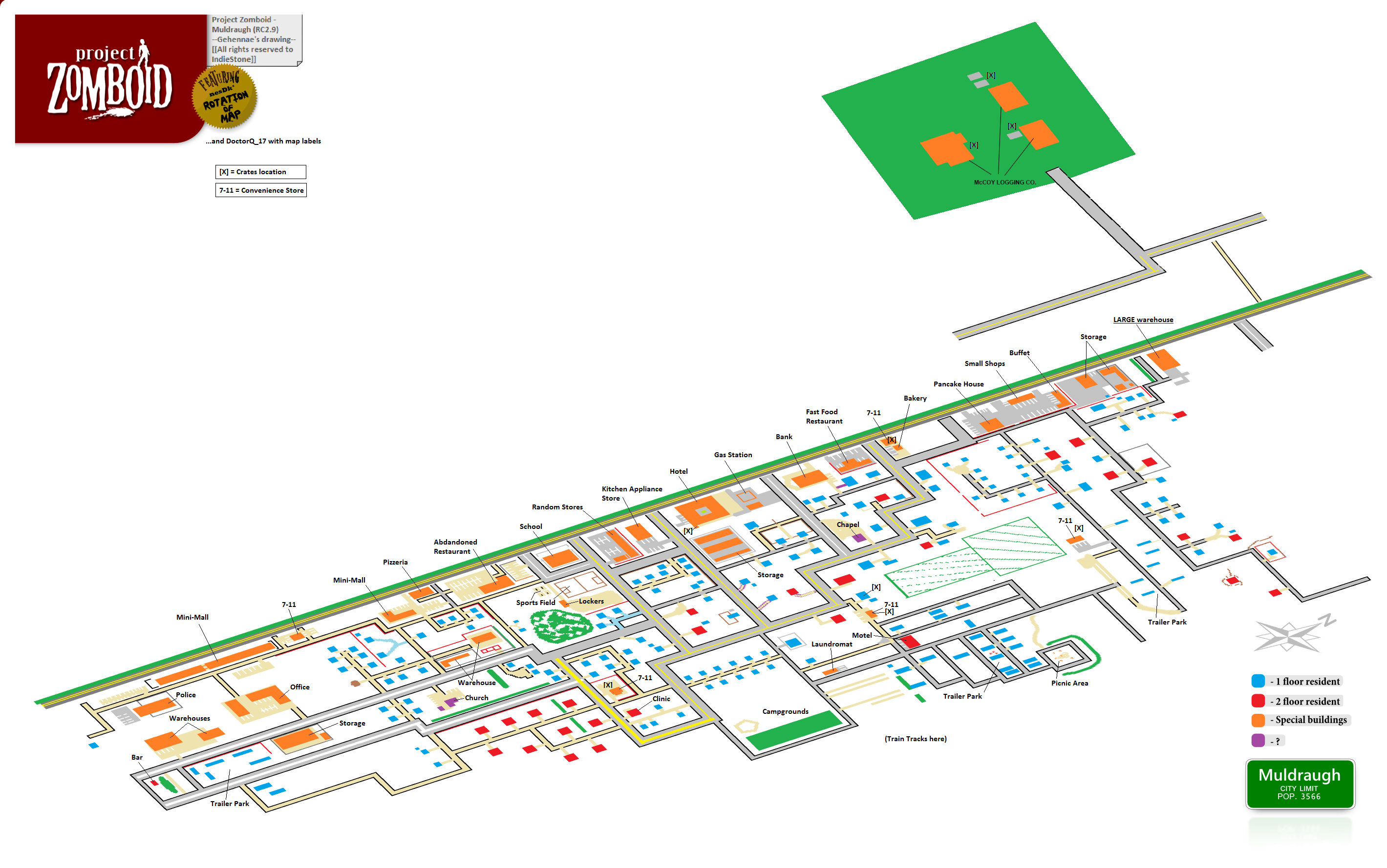
Map of Muldraugh with labeled locations
File history
Click on a date/time to view the file as it appeared at that time.
| Date/Time | Thumbnail | Dimensions | User | Comment | |
|---|---|---|---|---|---|
| current | 15:21, 5 June 2013 | | 2,839 × 1,779 (392 KB) | Matt (talk | contribs) | |
| 00:03, 19 May 2013 |  | 2,839 × 1,179 (344 KB) | DoctorQ 17 (talk | contribs) | Map of Muldraugh with labeled locations |
You cannot overwrite this file.