

Knox Country/th: Difference between revisions
(Created page with "{{languages:Category:TH}}{{header|The Game World|Maps|version=Version 41|incver=65}}{{Notice|Underconstruction}} File:Pzmap-comparison.jpg|thumb|link={{filepath:Pzmap-compar...") |
No edit summary |
||
| Line 2: | Line 2: | ||
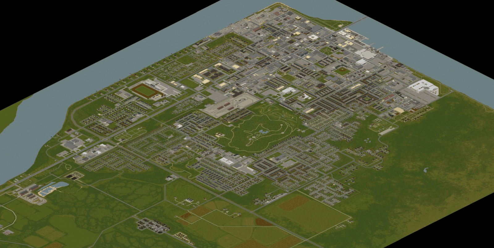
[[File:Pzmap-comparison.jpg|thumb|link={{filepath:Pzmap-comparison.jpg}}|เปรียบเทียบขนาดแผนที่ระหว่างตัวเกมกับของจริงในมุมมองจากด้านบน]] | [[File:Pzmap-comparison.jpg|thumb|link={{filepath:Pzmap-comparison.jpg}}|เปรียบเทียบขนาดแผนที่ระหว่างตัวเกมกับของจริงในมุมมองจากด้านบน]] | ||
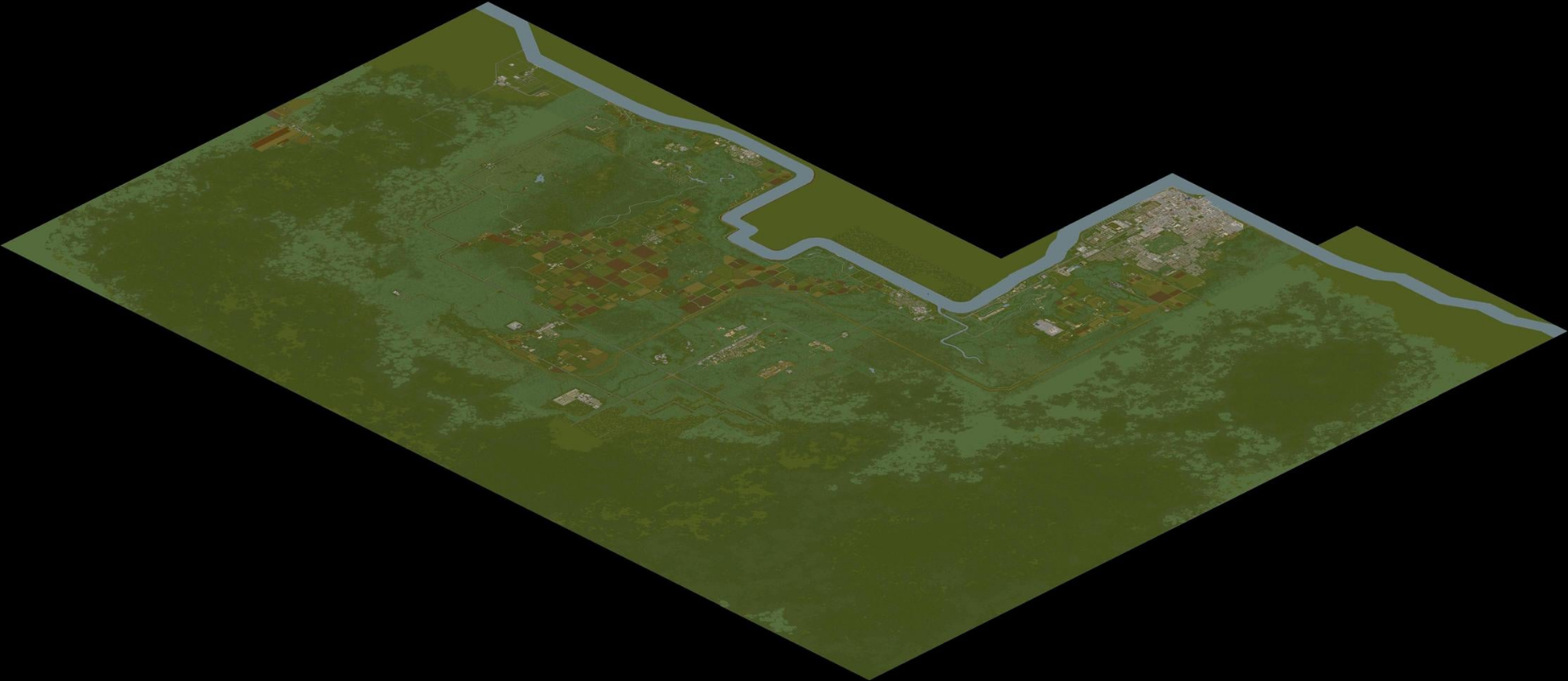
[[File:Pzmap-map.png|thumb|link={{filepath:Pzmap-map.png}}|รูปภาพแผนที่ในเกมที่ชื่อ "น๊อกซ์ คันทรี"]] | [[File:Pzmap-map.png|thumb|link={{filepath:Pzmap-map.png}}|รูปภาพแผนที่ในเกมที่ชื่อ "น๊อกซ์ คันทรี"]] | ||
{{About| | {{About|เป็นแผนที่ในปัจจุบันของ Project Zomboid|สำหรับแผนที่เวอร์ชั่นก่อนหน้า [[Version history#1|0.2.0r]]|น๊อกซ์ คันทรี่}} | ||
'' | ''ขอขอบคุณจากความพยายามของ [[Blindcoder]], ที่ทำให้มี [https://map.projectzomboid.com/ แผนที่แบบ interactive] ฉบับสมบูรณ์ให้แก่ชุมชน PZ ของเรา. คุณสามารถช่วยเขาในการขยายโครงการได้โดยไปที่ [https://theindiestone.com/forums/index.php?/topic/78-project-zomboid-map-project/ ฟอรั่มจากผู้พัตนา]ได้โดยตรง. | ||
''' | '''น๊อกซ์คันทรี''', หรือชื่อเดิม '''น๊อกซ์เคาน์ตี้''', เป็นพื้นที่ที่เกิดเหตุการสมมุติในเกม [[Project Zomboid]] . โดยแผนที่ของเกมนี้พื้นฐานมาจากสถานที่จริงบริเวธ [[wikipedia:Fort Knox|ค่ายน๊อกซ์]] และ [[wikipedia:Louisville, Kentucky|ลุยส์วิลล์]] ทางตอนเหนือของ [[wikipedia:Kentucky|รัฐเคนทักกี สหรัฐอเมริกา]]. ซึ่งน๊อกซ์คันทรีแห่งนี้ได้ใส่ เมืองจริงๆอย่าง [[Muldraugh, KY|มัลโดรว]], [[West Point, KY|เวสต์พอยต์]], [[Dixie]], [[March Ridge, KY|มาร์ชริดจ์]], and [[Louisville, KY|ลุยส์วิลล์]]. There are also some entirely fictional towns within Project Zomboid, including: [[Rosewood, KY|Rosewood]] and [[Riverside, KY|Riverside]]. | ||
Knox Country was just your standard, peaceful countryside region until an outbreak of a mysterious illness that reanimates infected persons into [[zombie]]s, later coined the [[Knox Infection]]. Fearing further spread, The U.S Government designated Knox Country as an exclusion zone, quarantined the area and prevented any information from reaching the outside world. | Knox Country was just your standard, peaceful countryside region until an outbreak of a mysterious illness that reanimates infected persons into [[zombie]]s, later coined the [[Knox Infection]]. Fearing further spread, The U.S Government designated Knox Country as an exclusion zone, quarantined the area and prevented any information from reaching the outside world. | ||
Revision as of 15:05, 9 May 2022
Template:Languages:Category:TH
{{Improve}}. Last edit was 09/05/2022.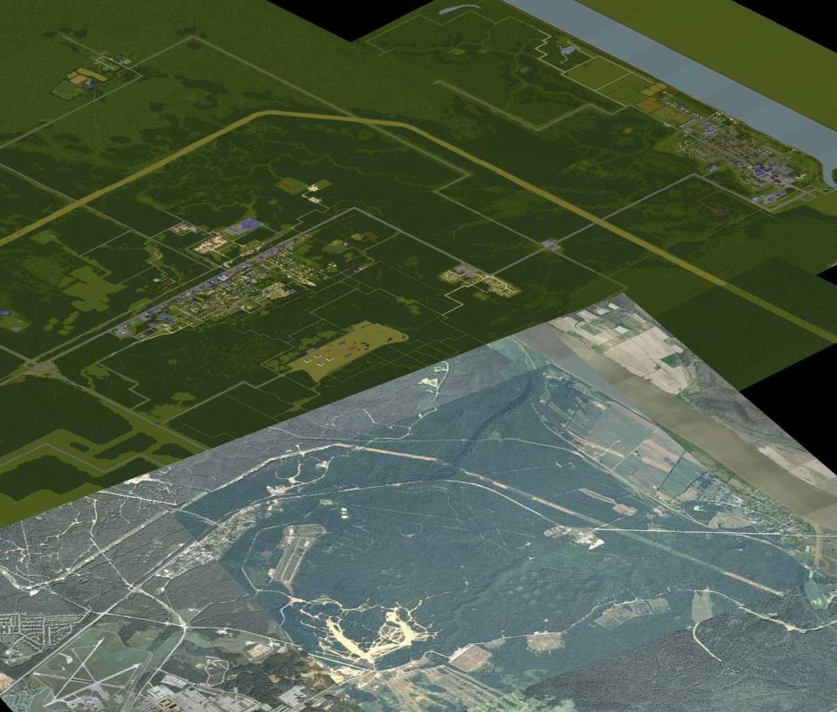
 This article is about เป็นแผนที่ในปัจจุบันของ Project Zomboid. For สำหรับแผนที่เวอร์ชั่นก่อนหน้า 0.2.0r, see น๊อกซ์ คันทรี่.
ขอขอบคุณจากความพยายามของ Blindcoder, ที่ทำให้มี แผนที่แบบ interactive ฉบับสมบูรณ์ให้แก่ชุมชน PZ ของเรา. คุณสามารถช่วยเขาในการขยายโครงการได้โดยไปที่ ฟอรั่มจากผู้พัตนาได้โดยตรง.
น๊อกซ์คันทรี, หรือชื่อเดิม น๊อกซ์เคาน์ตี้, เป็นพื้นที่ที่เกิดเหตุการสมมุติในเกม Project Zomboid . โดยแผนที่ของเกมนี้พื้นฐานมาจากสถานที่จริงบริเวธ ค่ายน๊อกซ์ และ ลุยส์วิลล์ ทางตอนเหนือของ รัฐเคนทักกี สหรัฐอเมริกา. ซึ่งน๊อกซ์คันทรีแห่งนี้ได้ใส่ เมืองจริงๆอย่าง มัลโดรว, เวสต์พอยต์, Dixie Mobile Park, มาร์ชริดจ์, and ลุยส์วิลล์. There are also some entirely fictional towns within Project Zomboid, including: Rosewood and Riverside.
Knox Country was just your standard, peaceful countryside region until an outbreak of a mysterious illness that reanimates infected persons into zombies, later coined the Knox Infection. Fearing further spread, The U.S Government designated Knox Country as an exclusion zone, quarantined the area and prevented any information from reaching the outside world.
Muldraugh, KY
- Main article: Muldraugh, KY/th

One of the more moderately-sized towns in Knox Country, made up mostly of residential and industrial buildings. Many of the residents live in poorer quality housing than residents in other towns. Some points of interest in town include:
Riverside, KY
- Main article: Riverside, KY/th

A town on the Ohio River in the north-west corner of Knox Country.
Some points of interest in town include:
Rosewood, KY
- Main article: Rosewood, KY/th
A newly-developed town with compact services and a nearby prison.
Some points of interest in town include:
West Point, KY
- Main article: West Point, KY/th
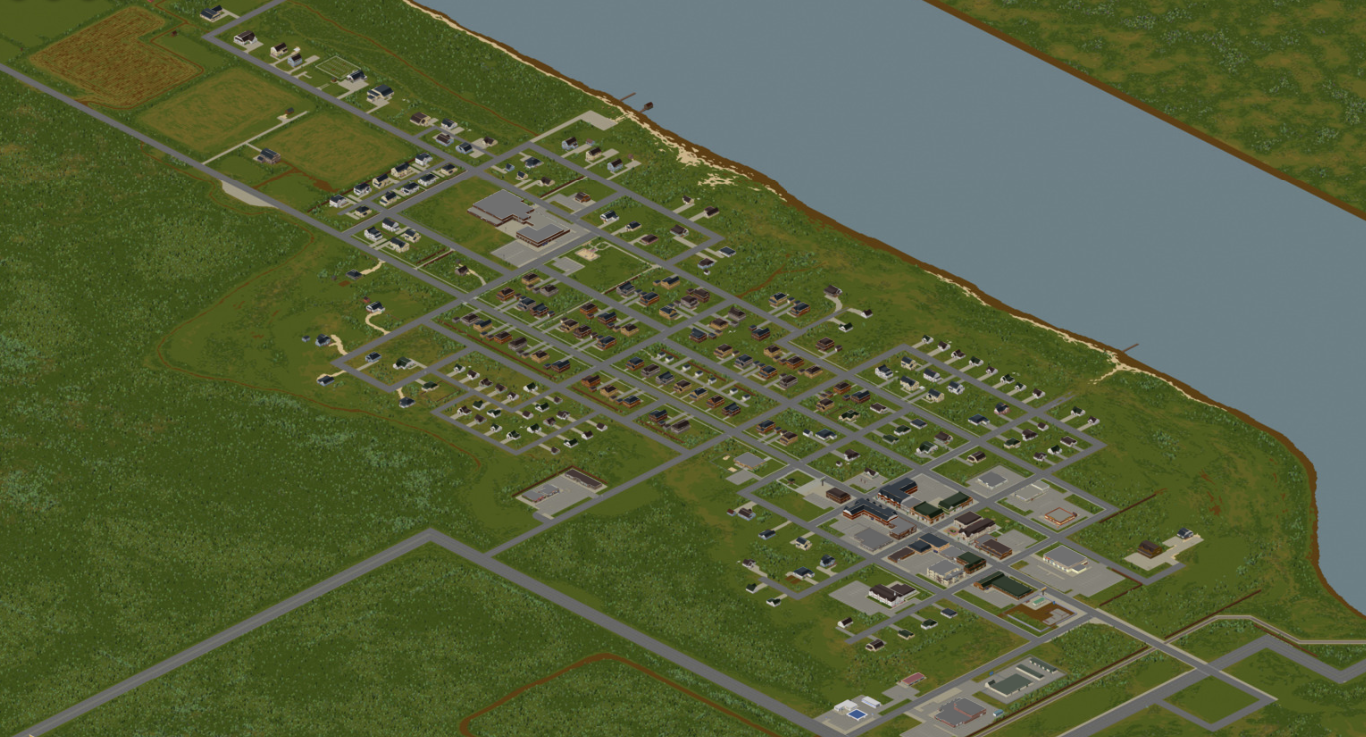
A large river-bound town north of Muldraugh with a clear town center and a close proximity to the Ohio River crossings.
Some points of interest in town include:
Valley Station, KY
- Main article: Valley Station, KY/th

A sparse town across the Ohio River whose main attraction is its sizeable mall.
Some points of interest in town include:
Louisville, KY
- Main article: Louisville, KY/th
A large, densely populated metropolis across the Ohio River on the border of the Knox Exclusion Zone. Later designated part of the exclusion zone after being overrun. Most of the city's borders are still sealed off by fences constructed during the Knox Event.
Some points of interest in the city include:
- 93.2 LBMW - Kentucky Radio Building (12477x1770)
- LBMW Network Building (12342x2068)
- St. Peregrin Hospital
- Louisville border camp
- Louisville Police Department and Detention Services
- Louisville Expo Center
- Spiffo's Headquarters
- Art Gallery of Louisville
- Fossoil Refinery
- Ready Prep Army Issue Surplus (12222x1320)
- Louisville General Hospital (12944x2093)
- Louisville Medical Center (12416x1761)
- Louisville Fire Department (12361x1755)
- Louisville Train Station (12698x2345)
- Louisville State University
- The Grand Ohio Mall
- Fossoil Field
- Triple-N Network Building (12648x1927)
March Ridge, KY
- Main article: March Ridge, KY/th
A gated military settlement made up of tenement buildings and surrounded by forest.
Some points of interest in town include:
Dixie Mobile Park
- Main article: Dixie/th

A trailer park which takes its name from the Dixie Highway on which it lies.
Points of interest in this settlement include:
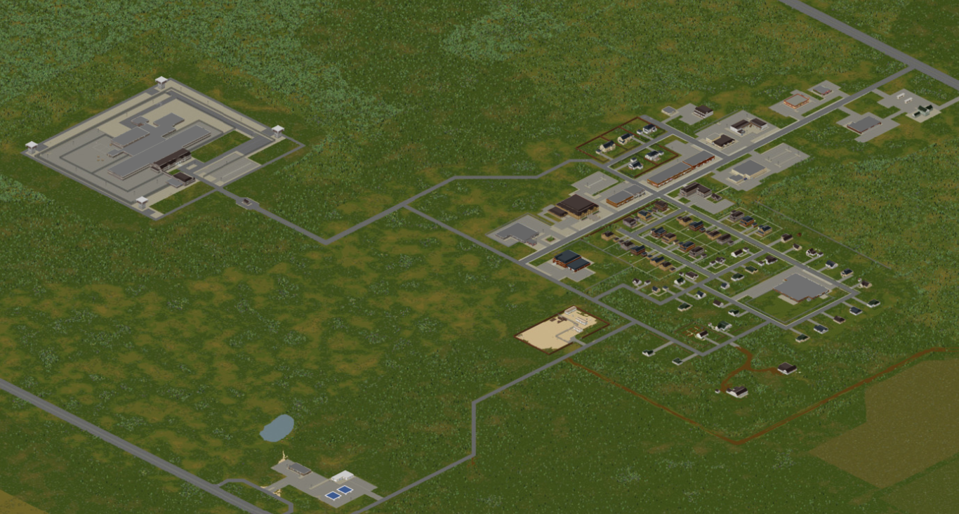
Ekron, KY
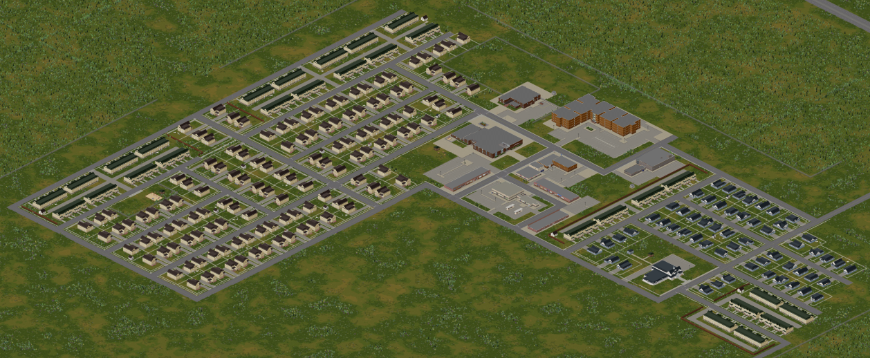
- Main article: Ekron, KY/thFile:Ekron thumb.pngAn isometric view of Ekron
A rural town surrounded by farmland in the center of Knox Country. Features an oddly shaped lake.
Points of interest in this town include:
Trivia
- Knox Country was previously called Knox County, which was renamed in 2013 after the original map was scrapped and remade.