

Knox Country: Difference between revisions
(Added links) |
|||
| Line 3: | Line 3: | ||
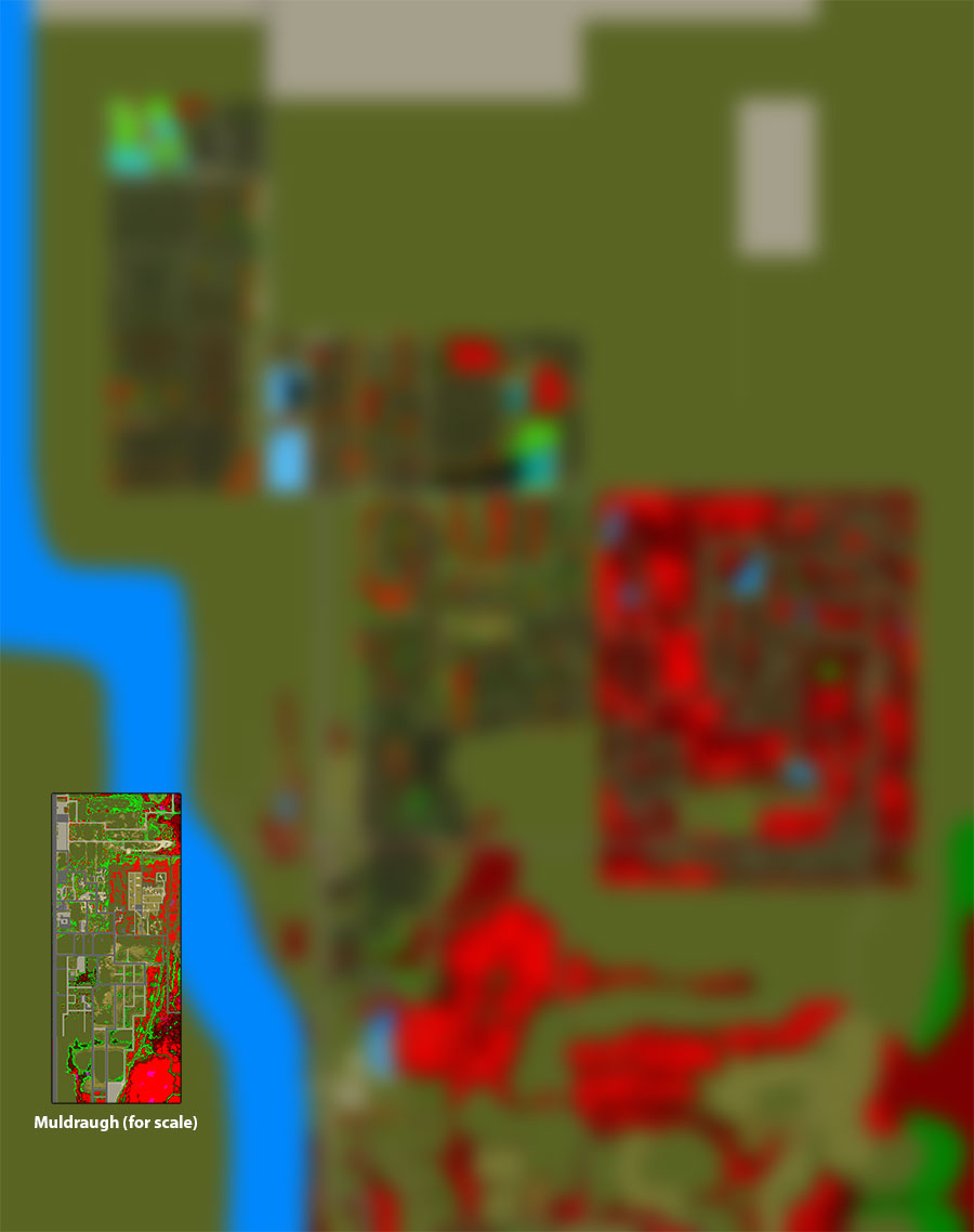
[[File:Knox_County.png|thumb|link={{filepath:Knox_County.png}}|A picture of the in-game Knox Country map.(''click to enlarge'')]] | [[File:Knox_County.png|thumb|link={{filepath:Knox_County.png}}|A picture of the in-game Knox Country map.(''click to enlarge'')]] | ||
{{About|the current map for Project Zomboid|the map prior to [[Version history#1|0.2.0r]]|[[Knox County]]}} | {{About|the current map for Project Zomboid|the map prior to [[Version history#1|0.2.0r]]|[[Knox County]]}} | ||
''Thanks to the efforts of [[Blindcoder]], a complete and [https://map.projectzomboid.com/ fully interactive map] has been made available to the community. You can assist in his efforts on expanding the project by visiting the [ | ''Thanks to the efforts of [[Blindcoder]], a complete and [https://map.projectzomboid.com/ fully interactive map] has been made available to the community. You can assist in his efforts on expanding the project by visiting the [https://theindiestone.com/forums/index.php?/topic/78-project-zomboid-map-project/ thread on the forums]. | ||
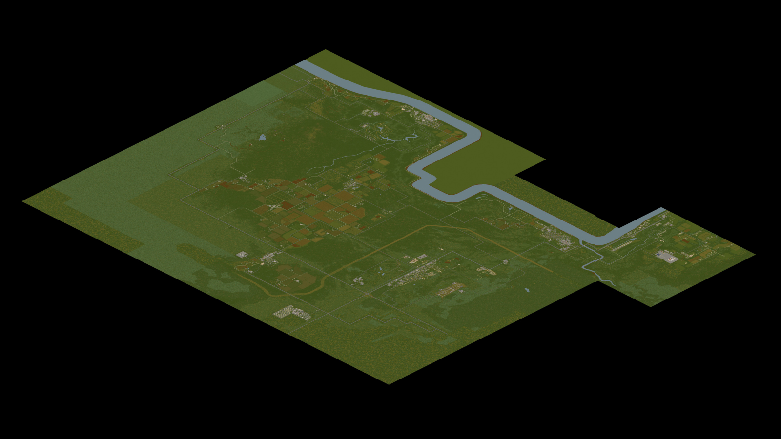
'''Knox Country''', previously called '''Knox County''', is a partially fictional area where the events of [[Project Zomboid]] take place. The map is heavily based off of the real-world area around [[wikipedia:Fort Knox|Fort Knox]] and [[wikipedia:Louisville, Kentucky|Louisville]] in northern [[wikipedia:Kentucky|Kentucky, USA]]. Knox Country contains recreations of the real-world [[Muldraugh, KY|Muldraugh]], [[West Point, KY|West Point]], [[ | '''Knox Country''', previously called '''Knox County''', is a partially fictional area where the events of [[Project Zomboid]] take place. The map is heavily based off of the real-world area around [[wikipedia:Fort Knox|Fort Knox]] and [[wikipedia:Louisville, Kentucky|Louisville]] in northern [[wikipedia:Kentucky|Kentucky, USA]]. Knox Country contains recreations of the real-world [[Muldraugh, KY|Muldraugh]], [[West Point, KY|West Point]], [[Dixie]] and [[March Ridge, KY|March Ridge]], with [[Fort Knox]] and [[Louisville, KY|Louisville]] [[Planned Features|planned]] to be added. There are also some entirely fictional towns within Project Zomboid, including: [[Rosewood, KY|Rosewood]], [[Riverside, KY|Riverside]], [[Crossroads Mall]] and [[Knox Penitentiary]]. | ||
Knox Country was previously called [[Knox County]], which was renamed in 2013 after the original map was scrapped and remade. Prior to the remake, the entire town of Muldraugh fit into one cell, whereas the [[Build 40|40.43 version]] is made up of 8 cells. The map has since been heavily inspired by the satellite view of the real towns of [http://i.imgur.com/Tchuy8d.png Muldraugh and West Point] | Knox Country was previously called [[Knox County]], which was renamed in 2013 after the original map was scrapped and remade. Prior to the remake, the entire town of Muldraugh fit into one cell, whereas the [[Build 40|40.43 version]] is made up of 8 cells. The map has since been heavily inspired by the satellite view of the real towns of [http://i.imgur.com/Tchuy8d.png Muldraugh and West Point] | ||
Future locations are rumoured to be Louisville, Fort Knox and [[Brandenburg]], along with countless areas of forest, small towns and farms. <!-- | Future locations are rumoured to be [[Louisville, KY|Louisville]], [[Fort Knox]] and [[Brandenburg]], along with countless areas of forest, small towns and farms. <!-- | ||
Lousiville = North of Valley Station | Lousiville = North of Valley Station | ||
Fort Knox = South-East of March Ridge | Fort Knox = South-East of March Ridge | ||
| Line 24: | Line 24: | ||
'''Some points of interest in town:''' | '''Some points of interest in town:''' | ||
*Diner | *[[Diner]] | ||
*Burger joint | *[[Burger]] joint | ||
* | *[[Laundromat]]s | ||
*Pile'o'Crepe | *[[Pile'o'Crepe]] | ||
*Zippee Market | *[[Zippee Market]] | ||
*Spiffo's | *[[Spiffo's]] | ||
*Knox Bank | *[[Knox Bank]] | ||
* | *[[Filling station]] | ||
*[[Sunstar Motel]] | *[[Sunstar Motel]] | ||
*Muldraugh | *[[Muldraugh Elementary School]] | ||
*Pizza Whirled | *[[Pizza Whirled]] | ||
*Tattoo | *[[Tattoo Parlor]], [[Bail Bonds]] | ||
*Farmer's market | *Farmer's market | ||
*Mini-mall | *Mini-mall | ||
*Police station | *[[Police station]] | ||
*Trailer park with about 20 trailers and associated motel | *Trailer park with about 20 trailers and associated motel | ||
*Church | *[[Church]] | ||
*[[Cortman Medical]] | *[[Cortman Medical]] | ||
*Autoshop | *[[Autoshop]] | ||
The rest of the 302 buildings include houses, warehouses, sheds, and mansions. | The rest of the 302 buildings include houses, warehouses, sheds, and mansions. | ||
| Line 52: | Line 52: | ||
'''Some points of interest in town:''' | '''Some points of interest in town:''' | ||
*Twiggy's | *[[Twiggy's]] | ||
*Spiffo's | *[[Spiffo's]] | ||
*Knox Bank | *[[Knox Bank]] | ||
*Enigma Books and Mendys eatery | *[[Enigma Books]] and Mendys eatery | ||
*Hair-o-Genesis | *[[Hair-o-Genesis]] | ||
*Seahorse Coffee | *[[Seahorse Coffee]] | ||
*School | *[[School]] | ||
*Candy Shop | *[[Candy Shop]] | ||
*Church and Cemetary | *[[Church and Cemetary]] | ||
*Thunder Gas | *[[Thunder Gas]] | ||
*Motel | *[[Motel]] | ||
*Police Station | *[[Police Station]] | ||
*The Drake and Crystal Pie Place | *[[The Drake and Crystal Pie Place]] | ||
*Gun Shop | *[[Gun Shop]] | ||
*GIGA Mart | *[[GIGA Mart]] | ||
*Hardware Store and Book Market | *[[Hardware Store]] and [[Book Market]] | ||
*Book Store | *[[Book Store]] | ||
*Pharmahug | *[[Pharmahug]] | ||
*Laudromat | *[[Laudromat]] | ||
*Autoshop | *[[Autoshop]] | ||
*Warehouse | *[[Warehouse]] | ||
*Boat Launch | *[[Boat Launch]] | ||
==Valley Station, KY== | ==Valley Station, KY== | ||
| Line 82: | Line 82: | ||
'''Some points of interest in town:''' | '''Some points of interest in town:''' | ||
*Academy | *[[Academy]] | ||
*Burger Shop | *[[Burger Shop]] | ||
*Church | *[[Church]] | ||
*Construction | *[[Construction site]]s | ||
*Destroyed Cabin | *[[Destroyed Cabin]] | ||
*Diner | *[[Diner]] | ||
*Food Market | *[[Food Market]] | ||
* | *[[Filling station]] | ||
*Gas | *[[Filling station#Gas 2 Go|Gas 2 Go]] | ||
*Knox Bank | *[[Knox Bank]] | ||
* | *[[Race Track]] | ||
*Shooting Range | *[[Shooting Range]] | ||
*Dock | *[[Dock]] | ||
*Shop | *Shop | ||
*Bus Station | *[[Bus Station]] | ||
*Zippee Mart | *[[Zippee Mart]] | ||
*StarEPlex Cinema | *[[StarEPlex Cinema]] | ||
*Crossroads Mall | *[[Crossroads Mall]] | ||
*Yummmers Bar | *[[Yummmers Bar]] | ||
*Pile | *[[Pile o' Crepe]] | ||
* | *[[Churns-R-Us]] | ||
*Zippee Market | *[[Zippee Market]] | ||
*Knob Creek Hunting Lodge | *[[Knob Creek Hunting Lodge]] | ||
*Guns-a-BlazINN | *[[Guns-a-BlazINN]] | ||
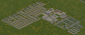
==March Ridge, KY== | ==March Ridge, KY== | ||
| Line 111: | Line 111: | ||
[[File:March_Ridge.png|thumb|link={{filepath:Ridge.png}}|A map of March Ridge (''click to enlarge'')]] | [[File:March_Ridge.png|thumb|link={{filepath:Ridge.png}}|A map of March Ridge (''click to enlarge'')]] | ||
'''Some points of interest in town:''' | '''Some points of interest in town:''' | ||
*March Ridge Community Center | *[[March Ridge Community Center]] | ||
*Family Medical Center | *[[Family Medical Center]] | ||
*Pharmahug | *[[Pharmahug]] | ||
*Food Market | *[[Food Market]] | ||
*Bakery | *[[Bakery]] | ||
*Mendy's Eatery | *[[Mendy's Eatery]] | ||
*Restaurant | *[[Restaurant]] | ||
* | *[[Valu Insurance]] | ||
*Family Fashion | *[[Family Fashion]] | ||
* | *[[Filling station]] | ||
*Post Office | *[[Post Office]] | ||
*School | *[[School]] | ||
*Cinema | *[[Cinema]] | ||
*Church | *[[Church]] | ||
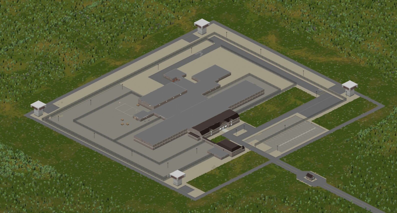
==Rosewood, KY== | ==Rosewood, KY== | ||
| Line 131: | Line 131: | ||
[[File:Knox_Penitentiary.png|thumb|link={{filepath:Knox_Penitentiary.png}}|A map of Knox Penitentiary (''click to enlarge'')]] | [[File:Knox_Penitentiary.png|thumb|link={{filepath:Knox_Penitentiary.png}}|A map of Knox Penitentiary (''click to enlarge'')]] | ||
'''Some points of interest in town:''' | '''Some points of interest in town:''' | ||
*Knox Penetentiary | *[[Knox Penetentiary]] | ||
*Courthouse | *[[Courthouse]] | ||
*Police Station | *[[Police Station]] | ||
*Fire Department | *[[Fire Department]] | ||
*Mama McFudgington's | *[[Mama McFudgington's]] | ||
*Bank | *[[Bank]] | ||
*Zippee Market | *[[Zippee Market]] | ||
*Rosewood Medical | *[[Rosewood Medical]] | ||
*Buffet | *[[Buffet]] | ||
*Motel | *[[Motel]] | ||
*Grocery store | *[[Grocery store]] | ||
*Church | *[[Church]] | ||
*School | *[[School]] | ||
*Construction Site | *[[Construction Site]] | ||
* | *[[Filling station]] | ||
*Fossoil | *[[Fossoil]] | ||
*Autoshop | *[[Autoshop]] | ||
*Pizza Whirled | *[[Pizza Whirled]] | ||
*Spiffo's | *[[Spiffo's]] | ||
==Dixie== | ==Dixie== | ||
| Line 159: | Line 159: | ||
*Trailer park | *Trailer park | ||
*Food Market | *Food Market | ||
*Diner | *[[Diner]] | ||
* | *[[Filling station]] | ||
*Laundromat | *[[Laundromat]] | ||
*Barg-n-Clothes | *[[Barg-n-Clothes]] | ||
*Gas 2 Go | *[[Filling station#Gas 2 Go|Gas 2 Go]] | ||
*Spiffo's | *[[Spiffo's]] | ||
*Nolan's Used Cars | *[[Nolan's Used Cars]] | ||
==Riverside, KY== | ==Riverside, KY== | ||
| Line 172: | Line 172: | ||
'''Some points of interest in town:''' | '''Some points of interest in town:''' | ||
*Knox Heights Country Club | *Knox Heights Country Club | ||
*Fossoil | *[[Filling station#Fossoil|Fossoil]] | ||
*Police Station | *[[Police Station]] | ||
*Spiffo's | *[[Spiffo's]] | ||
*Hotel | *[[Hotel]] | ||
*Pharmahug | *[[Pharmahug]] | ||
* | *[[Enigma Books]] | ||
*Church | *[[Church]] | ||
*GIGA Mart | *[[GIGA Mart]] | ||
*School | *[[School]] | ||
*Burgers | *[[Burgers]] | ||
*Cemetary | *[[Cemetary]] | ||
*Construction Site | *[[Construction Site]] | ||
*Churn-R-Us | *[[Churn-R-Us]] | ||
*Laundromat | *[[Laundromat]] | ||
*Factory | *[[Factory]] | ||
*Storage Sheds | *[[Storage Sheds]] | ||
*Diner | *[[Diner]] | ||
*Mechanic | *[[Mechanic (location|Mechanic]] | ||
*Trailer Park | *[[Trailer Park]] | ||
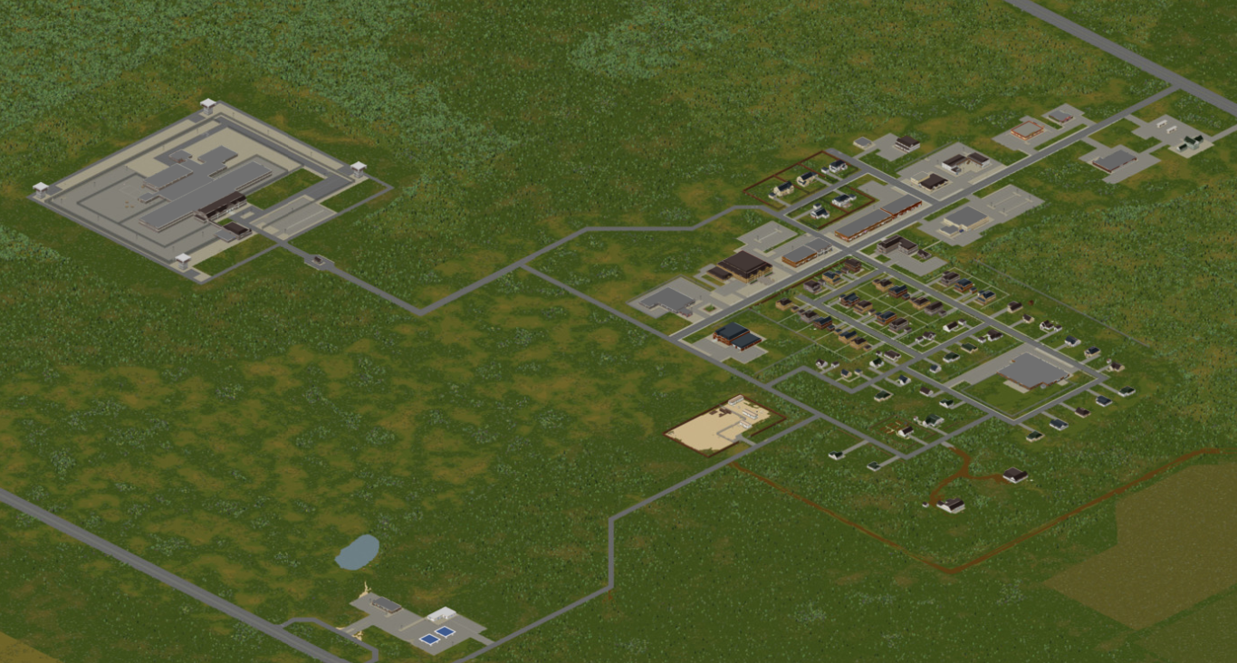
==Rural town and farmland== | ==Rural town and farmland== | ||
[[File:Rural_Town.png|thumb|link={{filepath:Rural_Town.png}}|A map of the rural town and farmland (''click to enlarge'')]] | [[File:Rural_Town.png|thumb|link={{filepath:Rural_Town.png}}|A map of the rural town and farmland (''click to enlarge'')]] | ||
'''Some points of interest in town:''' | '''Some points of interest in town:''' | ||
*Bar | *[[Bar]] | ||
*Laundromat | *[[Laundromat]] | ||
*Book Store | *[[Book Store]] | ||
*Doctor's Office | *[[Doctor's Office]] | ||
*Police Station | *[[Police Station]] | ||
*Farming & Rural Supply | *[[Farming & Rural Supply]] | ||
*Food Market | *[[Food Market]] | ||
*Bakery | *[[Bakery]] | ||
*Restaurant | *[[Restaurant]] | ||
*General Store | *[[General Store]] | ||
*E.P. Tools | *[[E.P. Tools | ||
*Burgers | *[[Burgers]] | ||
* | *[[Filling station]] | ||
*Church | *[[Church]] | ||
*Assembly Hall | *[[Assembly Hall]] | ||
*Pony Roam-O | *[[Pony Roam-O]] | ||
*Lake Fellis | *[[Lake Fellis]] | ||
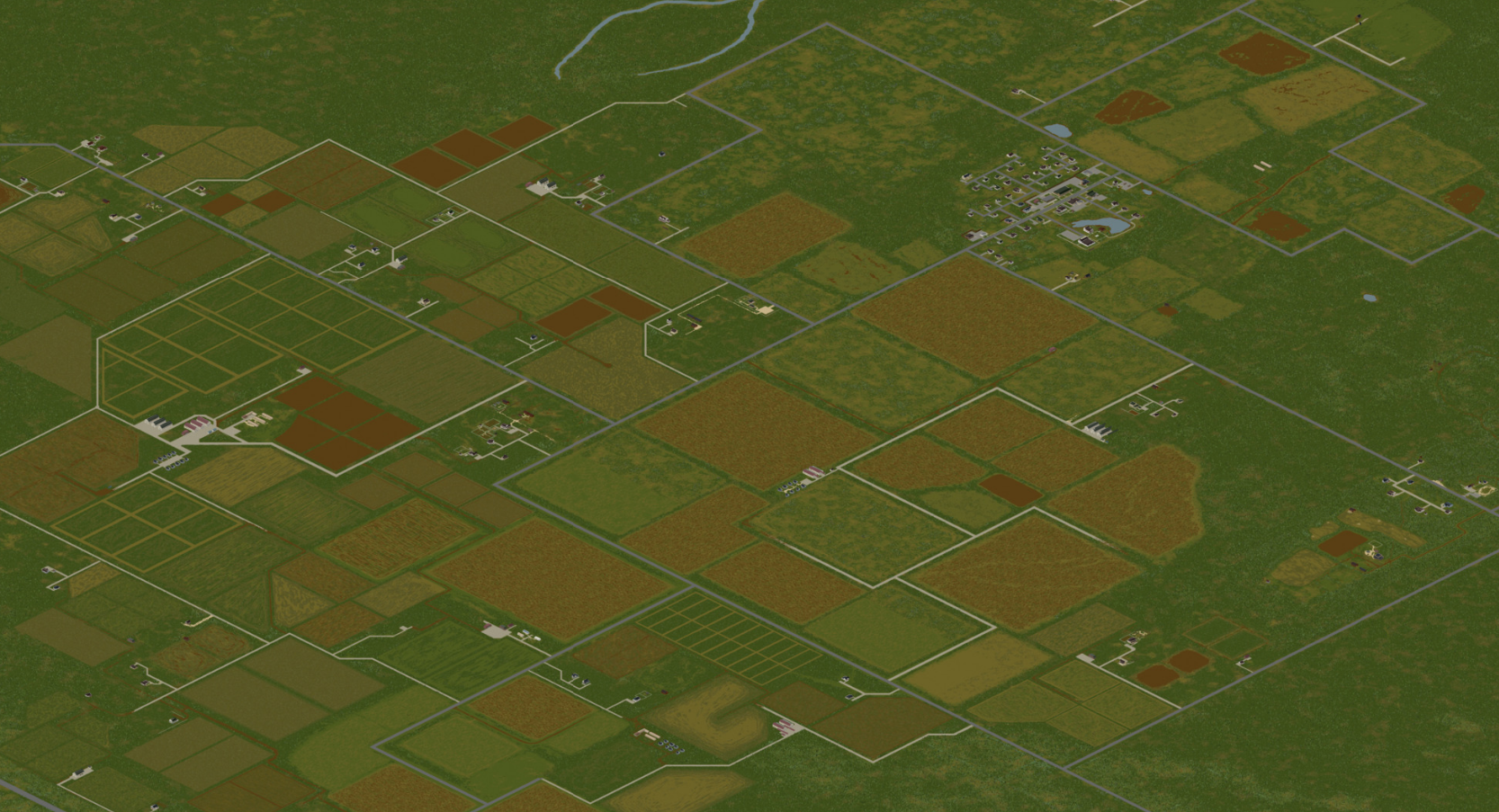
==Secret Government facility== | ==Secret Government facility== | ||
Revision as of 23:04, 18 July 2020
{{Improve}}. Last edit was 18/07/2020.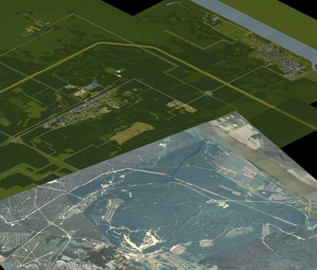
 This article is about the current map for Project Zomboid. For the map prior to 0.2.0r, see [[Knox County]].
Thanks to the efforts of Blindcoder, a complete and fully interactive map has been made available to the community. You can assist in his efforts on expanding the project by visiting the thread on the forums.
Knox Country, previously called Knox County, is a partially fictional area where the events of Project Zomboid take place. The map is heavily based off of the real-world area around Fort Knox and Louisville in northern Kentucky, USA. Knox Country contains recreations of the real-world Muldraugh, West Point, Dixie Mobile Park and March Ridge, with Planned features and Louisville planned to be added. There are also some entirely fictional towns within Project Zomboid, including: Rosewood, Riverside, Crossroads Mall and Kentucky State Prison.
Knox Country was previously called Knox County, which was renamed in 2013 after the original map was scrapped and remade. Prior to the remake, the entire town of Muldraugh fit into one cell, whereas the 40.43 version is made up of 8 cells. The map has since been heavily inspired by the satellite view of the real towns of Muldraugh and West Point
Future locations are rumoured to be Louisville, Planned features and Brandenburg, along with countless areas of forest, small towns and farms.
Muldraugh, KY
- Main article: Muldraugh

Muldraugh has 342 buildings of town and a former population of "3566". Forty of the buildings being the "Special" buildings noted below which usually have more loot, more valuable loot, or are just monuments of the pre-apocalyptic world.
Some points of interest in town:
- Diner
- Burger joint
- Laundromats
- Pile'o'Crepe
- Zippee Market
- Spiffo's
- Knox Bank
- Gas station
- Sunstar Motel
- Muldraugh Elementary School
- Pizza Whirled
- Tattoo Parlor, Bail Bonds
- Farmer's market
- Mini-mall
- Police station
- Trailer park with about 20 trailers and associated motel
- Church
- Cortman Medical
- Autoshop
The rest of the 302 buildings include houses, warehouses, sheds, and mansions.
West Point, KY
- Main article: West Point
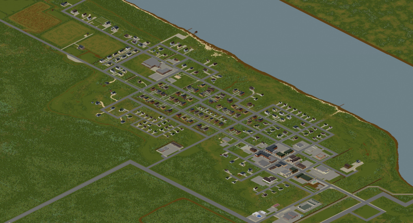
West point in terms of size, is smaller than Muldraugh. However, it has a larger population and population density than Muldraugh so zombies are clumped in larger packs.
Some points of interest in town:
- Twiggy's
- Spiffo's
- Knox Bank
- Enigma Books and Mendys eatery
- Hair-o-Genesis
- Seahorse Coffee
- School
- Candy Shop
- Church and Cemetary
- Thunder Gas
- Motel
- Police station
- The Drake and Crystal Pie Place
- Gun Shop
- GIGA Mart
- Hardware Store and Book Market
- Book Store
- Pharmahug
- Laudromat
- Autoshop
- Warehouse
- Boat Launch
Valley Station, KY
- Main article: Valley Station
A small area northeast of West Point and across the river with a few notable attractions. (There are only two access points across the river at this time)
Some points of interest in town:
- Academy
- Burger Shop
- Church
- Construction sites
- Destroyed Cabin
- Diner
- Food Market
- Gas station
- Gas 2 Go
- Knox Bank
- Race Track
- Shooting Range
- Dock
- Shop
- Bus Station
- Zippee Mart
- Star-E-Plex
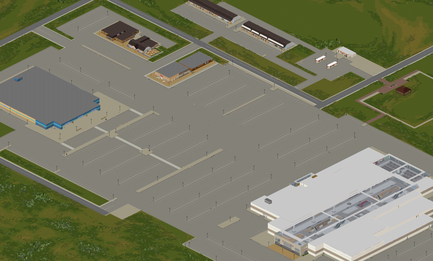
- Crossroads Mall
- Yummmers Bar
- Pile o' Crepe
- Churn R Us
- Zippee Market
- Knob Creek Hunting Lodge
- Guns-a-BlazINN
March Ridge, KY
- Main article: March Ridge
Some points of interest in town:
- March Ridge Community Center
- Family Medical Center
- Pharmahug
- Food Market
- Bakery
- Mendy's Eatery
- Restaurant
- ValuInsurance
- Family Fashion
- Gas station
- Post Office
- School
- Cinema
- Church
Rosewood, KY
- Main article: Rosewood
Some points of interest in town:
- Knox Penetentiary
- Courthouse
- Police station
- Fire department
- Mama McFudgington's
- Bank
- Zippee Market
- Rosewood Medical
- Buffet
- Motel
- Grocery store
- Church
- School
- Construction site
- Gas station
- Fossoil
- Autoshop
- Pizza Whirled
- Spiffo's
Dixie
- Main article: Dixie Mobile Park

Dixie is a trailer park just outside of Muldraugh on the way to West Point.
Some points of interest in town:
- Trailer park
- Food Market
- Diner
- Gas station
- Laundromat
- Barg-n-Clothes
- Gas 2 Go
- Spiffo's
- Nolan's Used Cars
Riverside, KY
- Main article: Riverside

Some points of interest in town:
- Knox Heights Country Club
- Fossoil
- Police station
- Spiffo's
- Hotel
- Pharmahug
- Enigma Books
- Church
- GIGA Mart
- School
- Burgers
- Cemetary
- Construction site
- Churn-R-Us
- Laundromat
- Factory
- Storage Sheds
- Diner
- Mechanic
- Trailer Park
Rural town and farmland
Some points of interest in town:
- Bar
- Laundromat
- Book Store
- Doctor's Office
- Police station
- Farming & Rural Supply
- Food Market
- Bakery
- Restaurant
- General Store
- [[E.P. Tools
- Burgers
- Gas station
- Church
- Assembly Hall
- Pony Roam-O
- Lake Fellis
Secret Government facility
Secret government facility added in secret with build 40.
Louisville, KY
- Main article: Louisville
Some points of interest in town:
- Cathedral with a pipe organ
- Multistory hospital
- Spiffo's headquarters
- Bridge(s) crossing the Ohio river (potentially collapsed)